Leaving Iron Bog camp ground we turned back the way we had come, and drove only a short way before pulling onto a small unmarked trail, hoping that it would lead down to the stream that we had been seeing for a couple of hours.
It did.
The short trail dead-ended right at the water and (knowing that) we quickly made the decision to park the Tahoe close to the road and just walk down.
There were no people at this place and for a few minutes we wandered slowly down to the water, enjoying the solitude of the experience.
LC and I are slowly (day by day) irrevocably becoming more anti social and loners.
We can deal with people in positive ways and can enjoy other people's company, but only for short periods of time before gratefully retreating into the silence that both of us increasingly need..................

LC immediately found a comfortable seat on a huge rock down by the stream, and I held onto Kory tightly as she enthusiastically waded into the fast moving water...............


We had wanted to venture into the mountains for a few weeks now but had not found the chance before this day.
By the time we had spent a few minutes wandering along the edge of the stream, and wandering on foot on short and overgrown trails, we both knew that it was again time to move on.
I knew from experience that there have been times in the past when we have traveled so fast and far, that at the end of the day I felt like we had passed by a lot, but not actually SEEN a lot.
This was beginning to turn into one of those days.
When we first picked up a little tent and began our journey on Antelope Road a few hours prior, we had only planned on taking a short drive.
But now we were definitely into a frame of mind to truly get the lay of the land.
What was back here? What was out here? What would we see and what would we find?
After hearing so many people talk about Iron Bog Camp Ground, I was pleased to finally see it.
It was beautiful, situated close to streams and trails and surrounded by pine trees and mountains.
So what else was out here?
As I wandered along the stream bed with my pup (who darted happily in and out of the water) I knew that our short drive was actually going to turn into a long day of exploration.
Of an entire region of the country that both of us had been curious about.
And that was OK.....................


One more stop at one more stream access.
This time we had pulled into a wide open span of desert grass and sage.
Parking we truck we headed across a narrow one-board bridge that spanned the same stream, and stood in awe of terrain that had completely and unexpectedly opened up to us................


Where did this trail go?
I wasn't going to find out on this day..................


30 more minutes drive and we reached the second camp ground.
We had bypassed it on the way in realizing that it was filled with campers and four wheelers.
On the way back we pulled down to the camp ground, looked in both directions, saw the campers and four wheelers and immediately decided that we did not want to stay.
Instead, straight ahead of us was a bridge (that crossed over the stream - or another stream - we weren't sure) and beyond the bridge was another gravel road.
A brightly colored sign announced that it was a fire service road.
Another sign (this one black and white) gave the go-ahead for trucks of different weights and sizes to drive it.
Well...........if it was OK for big trucks to go through, we figured that it was OK for a mid-sized Tahoe to navigate.
Curiosity again getting the better of us, we enthusiastically crossed over the bridge and picked up one more completely mysterious and unknown road.
We know better.
You don't go wandering into mountainous areas without............something. A map would have been a good idea.
We had an almost full tank of gas, 10 ply tires, food and water, first aid supplies and emergency gear.
At this point we did not believe that we needed any of those things, but a map would have been a good idea.
Regardless, at this point the road looked like a narrow albeit in-good-shape gravel road and we'd see what we saw.....................

Stopping briefly in the middle of the road to snap pictures of a huge area that had been swamped out by multiple beaver dams.................


30 minutes later we were standing at the top of the aptly named Beaver Creek Summit.
Elevation 7500 feet.
Hours before, we had passed a sign showing the name of a mountain that was at 11,000 feet elevation, so Beaver Creek seemed like a bump in the road in comparison.
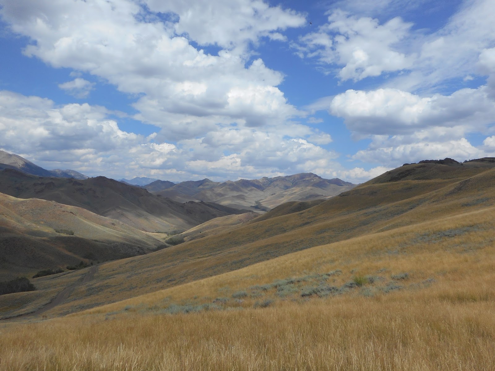
We had not seen even one piece of civilization during the drive through wide open plains, high rolling hills and the gradual climb up to Beaver Creek.
Instead there had only been barren and completely empty land.
Ready to wander again, we all three climbed out of the Tahoe, took a drink of water, and looked around us...................


By this time it was mid afternoon and the light was drastically beginning to change in beautiful ways.................


What is adventure? If a lone wolf lifts his plaintive call into the
moonlight near your campsite, you might call that adventure. While
you’re sweating like a horse on a climb over a 12,000 foot pass, that
could be adventure. When howling head winds press your lips against your
teeth, you face a mighty struggle. When your pack grows heavy on your
shoulders as your climb a 14,000 foot peak, you feel the adventure. When
you suffer freezing temperatures and 20 inches of fresh powder on a hut
to hut trip in the Rockies, that could be called adventure. But that’s
not what makes an adventure. It’s your willingness to conquer it, and to
present yourself at the doorstep of nature. That creates the
experience. No more greater joy can come from life than to live inside a
moment of adventure. It is the uncommon wilderness experience that
gives your life expectation.................Frosty Wooldridge, Golden, Colorado